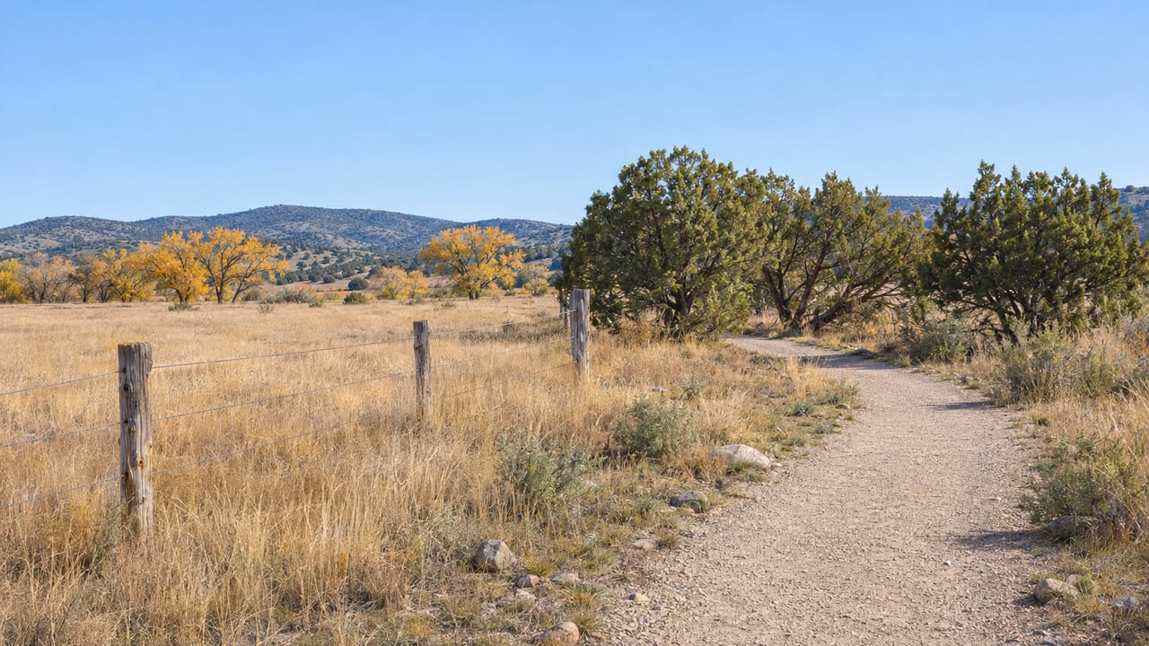
On the Town of Chino Valley's project map, the line marked "Existing Peavine Trail, Chino Valley" stops near a dirt parking lot off Road 4 South. South of it, the map shows Granite Creek Wash, and past the wash the line picks up again as "Existing Peavine Trail, City of Prescott." The Town's planned connection between those two labels runs from station 00+00 to station 109+18.19. That works out to about 10,900 feet, or a little more than two miles.
The Town's Community Services director has called the connection nearly 20 years in the making. The new funding shows where that time went. Its biggest line items cover a crossing at Granite Creek, which runs only some of the time, and fencing through the ranch land between the two trails.
The money, line by line
In August, Prescott eNews published the Town's announcement that Chino Valley won an award through the Arizona Department of Transportation's Transportation Alternatives Program for what the Town calls the Peavine Trail South Connection. The numbers:
- $2,569,072 from ADOT's Transportation Alternatives Program
- $155,289 in Town match
- $2,724,361 in total project investment
- $454,182 budgeted to take design from 30 percent to final
- About $2.27 million projected for construction
That match is a small share. According to the Daily Courier, the Town is covering only a 5.7 percent local match. When the Town listed the project's major parts, it named two: a concrete ford at Granite Creek and about 22,000 linear feet of game fencing. Both come straight from the ground the trail has to cross.
A ford, because the creek is usually dry
Part of the planned route lies in a Zone A, 100-year floodplain, so the trail needs a concrete ford where it crosses Granite Creek. A ford is a hard surface laid at creek-bed level that walkers, riders and horses cross directly. It is not a raised span.
This creek has shaped the Peavine for years. An earlier Daily Courier report on the link's planning said Prescott's Peavine ended at an old collapsed railroad bridge over Granite Creek. Prescott's trails coordinator said then that this part of the creek usually flows only when water is spilling over the Watson Lake spillway. Signs would warn trail users about the occasional flow that could close the trail for a while.
For a Chino Valley rider, that means the finished crossing will be dry and easy most of the year. The exceptions will be the times when Watson Lake is high enough to spill.
The fence line is the long part
The game fencing is the less visible half of the job. At 22,000 linear feet, it adds up to about 4.2 miles of fence. That's roughly enough to run along both sides of a two-mile trail. The Town estimates fencing materials alone at nearly $200,000. The Courier reported that the fencing is there to guide trail users safely through the corridor while protecting nearby properties and wildlife.
When the link was first being planned, the fencing estimate was smaller. The same earlier Courier piece put it at about $100,000, needed because cattle grazing would continue in the area. That plan also needed about a mile of right-of-way across Arizona State Trust Land. The material cost alone has now roughly doubled that earlier fencing figure. Running a public trail through working rangeland is what turns two miles of path into a multi-year project.
Jessi Sorteberg, the Town's executive analyst, led the grant application. She told the Courier, which identified her as the Town's grant writer, that the hardest part was finding a safe, workable route through an area with several property interests, heavy fencing needs and Granite Creek.
What the scope leaves for later
The connection is planned for walkers, cyclists and horseback riders. According to the Courier's report, the confirmed scope includes no trees or built shade areas. Any extra amenities depend on final design, available funding and maintenance planning. Restrooms and new parking aren't in the scope either. Access at the Chino Valley end is the existing dirt lot near the southern part of the trail, off Road 4 South.
Plan a summer ride on the finished link the way you'd plan any exposed high-desert trail. Carry your own water and pick the cooler part of the day.
The calendar runs through ADOT
When the Courier reported the award, an engineering firm and a construction company had not yet been selected. ADOT's active project list includes "PEAVINE TRAIL MUP, CHINO VALLEY," described as a shared-use path, with a current program budget of $2,271,000 in program fiscal year 29. The listed milestone to advertise the project for bids is August 25, 2028.
A bid advertisement is the point when contractors are invited to bid. Construction starts after that. ADOT's listed milestone falls almost two years after this month. The Town's own messaging is plain about where things stand. In the Town's announcement, Cyndi Thomas, Chino Valley's Director of Community Services, said:
"Connecting Chino Valley's Peavine Trail with Prescott's trail system has been a long time coming, and although the trail is not yet connected, this funding moves us significantly closer."
Mayor Tom Armstrong called the award "an exciting and historic step forward for Chino Valley" and credited past and present Town employees, community stakeholders and regional partners. In the same announcement, Thomas thanked Sorteberg and Public Works Assistant Director Steve Sullivan for their work on the funding.
Where to ride the Peavine this winter
Until the link opens, the Peavine is two separate trails, and both are open to ride now. Once connected, they'll add up to more than 18 miles. Chino Valley's section is about 5.8 miles and Prescott's is about 10.
- Chino Valley's section, north end. The trail runs about 5.8 miles on dirt, from East Perkinsville Road and Jerome Junction Road to a point about 2 miles east of State Route 89. It's listed for walking, mountain biking and horseback riding. There are two parking areas at the north end, one at East Perkinsville Road and Jerome Junction Road and one where the trail crosses East Road 2 North.
- Chino Valley's section, south end. The existing dirt lot off Road 4 South sits next to where the new connection will begin on the Town's map.
- Prescott's Peavine at Sundog Ranch. Sundog Ranch Peavine Trailhead is one of the City of Prescott's paid-parking locations. As of February 26, 2026, the daily fee went from $3 to $5. The annual pass stayed at $100, the 40-visit pass at $60 and the 10-visit pass at $20. Wednesdays are still free parking days. You can pay at the kiosk, or buy passes at the Recreation Services Department at 824 E. Gurley St., Monday through Friday from 8 a.m. to 4 p.m., or online. If you ride the Prescott side often, the annual pass pays for itself after 20 daily visits at the new rate.
This connection is separate from the longer-term plan to extend the Peavine north toward Del Rio Springs and the headwaters of the Verde River. We covered that northern direction in our Chino Valley summer guide to Del Rio Springs and the Peavine extension. Thomas told the Courier that the two projects together could create a trail corridor of roughly 25 miles connecting Prescott, Chino Valley and the new state park.
If you live near Road 4 South, Road 2 North or the Perkinsville end and wonder how a future trail connection might affect your property's appeal, Paula Stears Thomas and the PST team track these projects at the parcel level. Start with a free home valuation, and we'll talk through what the Peavine's path means for your corner of Chino Valley.